
Mani Peninsula
Part I (preamble & Oitylo Bay)
(updated October 2020)
It is like rocks be equal and stabbing, upright and naked, trackless and abandoned. (K.Palamas)
«Να κι οι Μανιάτες! Κι είν’ όπως είναι οι βράχοι τους: και σουβλεροί κι ολόρθοι, και ολόγυμνοι και απάτητοι και ξεμοναχιασμένοι». Κωστής Παλαμάς.
Orientation & Geography
The Mani Peninsula (Μάνη) is a geographical and cultural region in Greece that is home to the Maniots (Mανιάτες). Areopoli is the capital city of Mani. Mani is the central peninsula of the three, which extend southwards from the Peloponnese in southern Greece. To the east is the Laconian Gulf, to the west the Messenian Gulf. The peninsula forms a continuation of the Taygetos mountain range, the western spine of the Peloponnese. The name "Mani" may come from the name of the Frankish castle “le Grand Magne” (the location of which is not clear).
.")
Mani on the map (courtesy of google maps).
Until recent years many villages could be reached only by sea. Today, mainly thanks to tourism, a winding road extends along the west coast from Kalamata to Areopoli, then south to Cape Tenaro (the pointed cape, which is the southernmost point of continental Greece), before it turns north toward Gytheio, in the heart of Laconian Gulf. Another road, which is the road for those coming from Athens, comes from Tripoli through Sparta, bypasses Gytheio, and ends at Areopoli. Another road (narrow and winding) crosses the peninsula from west to east, connecting Areopoli to Kotronas. Of course, today, several smaller roads actually connect every village and settlement of Mani.

Mani has been traditionally divided into three regions: Exo Mani (Έξω Μάνη) or Outer Mani to the northwest, Kato Mani (Κάτω Μάνη) or Lower Mani to the east, and Mesa Mani (Μέσα Μάνη) or Inner Mani to the southwest.
Administratively, Mani is now divided between the Laconia (Kato Mani, Mesa Mani) and Messenia (Exo Mani) prefectures in the periphery of Peloponnesos. Still, in ancient times it lay entirely within Laconia, the district dominated by Sparta. The Messenian Mani (also called 'aposkiaderi', a local expression meaning "shady") receives somewhat more rainfall than the Laconian (called 'prosiliaki', a local expression meaning "sunny") and is consequently more productive in agriculture. Maniots from what is now Messenian Mani have surnames that regularly end in '-éas', whereas Maniots from what is now Laconian Mani have surnames that end in '-ákos'; additionally, there is the '-óggonas' ending, a corruption of 'éggonos', (grandson).

The Byzantine two-headed eagle carved at the facade of a house in Areopoli.
Areopoli, the “capital city” of Mani, is 280km from Athens, which means that one has to drive for about 3 hours and 30 minutes. Areopoli is a good base if you want to explore the area, as from there, the longest distance you have to drive is 40km to Cape Tenaro. Kalamata (the capital city of Messenia Prefecture) is only 80km from Areopoli, but it takes almost 2 hours to drive the coastal road. Sparta, the Laconia Prefecture capital, is 60 km to the north and only a one-hour drive away from Areopoli.

Sea and rock: the rough but enchanting landscape of Mani.
History Highlights
As the power of the Byzantine Empire declined, the peninsula drifted out of the Empire's control. Over the subsequent centuries, the peninsula was fought over by the Byzantines, the Franks (This term is used by Greeks to describe western Europeans collectively. The term appeared during the Crusades and continued to be used till the 19th cent. In several occasions, it is used even today) and the Saracens.
After the Fourth Crusade in 1204 AD, Italian and French knights occupied the Peloponnese and created the Principality of Achaea. They built the fortresses of Mystras, Passavas, Gustema (Beaufort), and Great Maina. The area fell under Byzantine rule after 1262, forming part of the Despotate of Morea. See also my page about Mystras fortified city by following this link: Mystras.
In 1460, after the fall of Constantinople, the Despotate fell to the Ottomans. Mani was not subdued and retained its internal self-government in exchange for an annual tribute, although this was only paid once. Local chieftains or “beys” governed Mani on behalf of the Ottomans: The first of these rulers, Liberakis Yerakaris, reigned in the middle of the seventeenth century.
During the forty-five years from 1776 to 1821, when the War of Independence broke out, the Mani was ruled by eight successive Beys, all except one of whom played the dangerous game of maintaining the interests of the Mani and of eventual Greek freedom while trying to remain on the right side of the Turks.

The English poet, writer, and libertine Lord Byron put all his wealth and ultimately his life into the War for Greek independence.
As Ottoman power declined, the Mani mountains became a stronghold of the klephts (follow the link to my page to read more about klephts: Klefts), bandits who also fought against the Ottomans. There is also evidence of a sizeable Maniot emigration to Corsica sometime during the Ottoman years. Petros Mavromichalis, the last bey of Mani, was among the Greek War of Independence leaders. He proclaimed the revolution at Areopoli on March 17, 1821. The Maniots contributed greatly to the struggle, but once Greek independence was won, they wanted to retain local autonomy. During the reign of Ioannis Kapodistrias, they violently resisted outside interference, to the extent of members of the Mavromichalis family killing Kapodistrias. Petrobey Mavromichalis himself has refused any involvement in the assassination.
 and Petros Mavromichalis-Petrobey (right).")
Ioannis Kapodistrias (left) and Petros Mavromichalis-Petrobey (right).
In 1878 the national government reduced the Mani's local autonomy. The area gradually became a backwater; inhabitants abandoned the land through emigration, with many going to major Greek cities and Europe and the United States. It was not until the 1970s, when the construction of new roads supported the tourist industry's growth, that the Mani began to regain population and become prosperous. In the last three decades, the area is very popular with tourists from Europe, mainly Germans and French, but thankfully massive tourism has not affected the place and did not spoil its “wild beauty”. The ancient tower-houses of Mani (pyrgospita) are significant tourist attractions and some offer accommodations for visitors.
Mani is also known for what is considered by many the world's best extra-virgin olive oil, soft-pressed from partially ripened olives of the Koroneiki variety, which are grown on mountain terraces.
I would recommend a good 10-day stay in Mani if you really want to get to know this magnificent land. Usually, people do not have that long holiday, so I tried to “squeeze” everything into 5 day-trips.
(follow the links below for each day-trip)
👍 DAY I Around Oitylo Bay
👍 DAY II Exo Mani
👍 DAY III Mesa Mani
👍 DAY IV Cavo Grosso
👍 DAY V Gytheio
day I
Around Oitylo Bay
. Various color lines show detours to places of interest.")
From Oitilo to Areopoli (orange line). Various color lines show detours to places of interest.

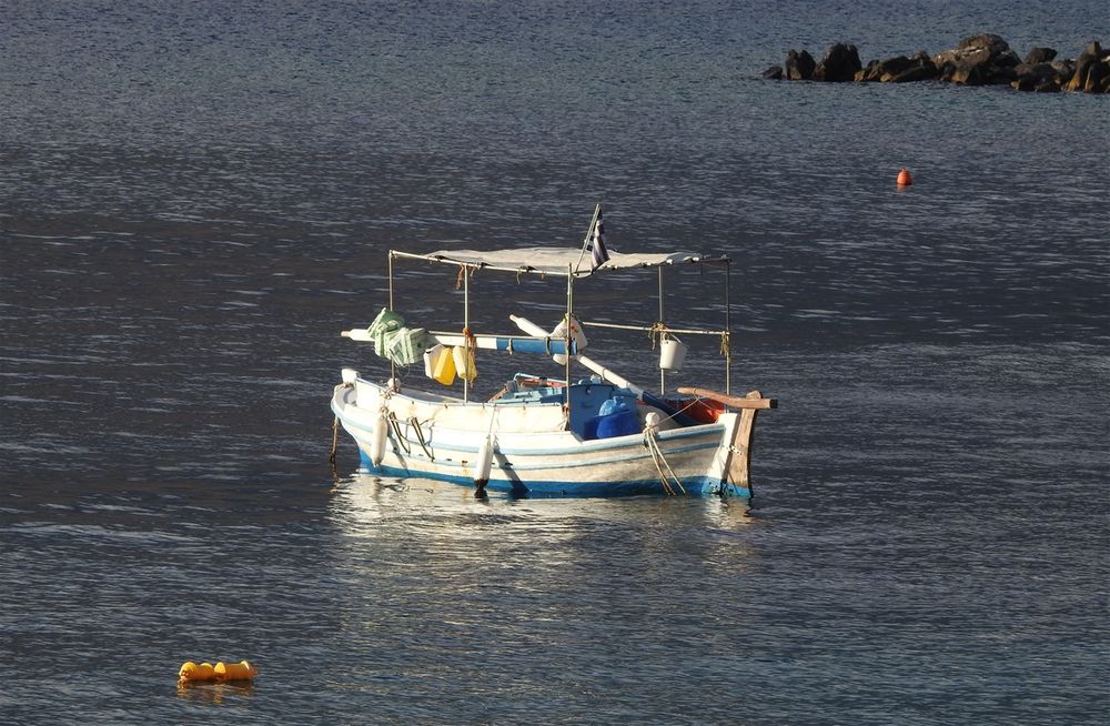
Oitylo bay.
During my stay in Mani, I decided to reside at “Itilo Hotel” located by the beach, 7km north of Areopoli in a protected gulf. The most picturesque village o Mani, Limeni, is also located. The place is ideal for beach holidays (not my type of holidays, though) and very convenient to explore the area. Hotel Itilo is a lovely (a bit expensive) hotel with beautiful rooms with sea and mountain views. The beach in front of it is not that good, but there is a small saltwater pool onsite. Breakfast is delicious.
"Itilo Hotel".
Neo Oitylo
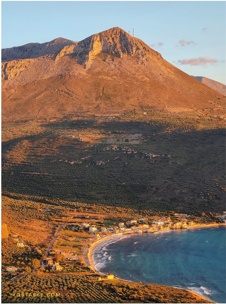
The hotel is located just outside Neo Oitylo (Νέο Οίτυλο) village, which is a little seaside settlement with several cafés and restaurants by the sea. There is no real tourist interest for Neo Oitylo, but the sunset from here is just majestic, as the sun during the summer months goes down into the sea between the two rocky edges of the gulf.
During my last visit (October 2020) to the area, I “discovered” a great tavern on the rocky beach of Neo OItilo. “Karavopetra Tavern” («Καραβόπετρα») is a traditional tavern with delicious food. It took its name from the rocks in front of it (karavopetra, karavi=boat + petra=rock), where seamen used to tie up their boats when they transported merchandise to supply this part of Mani. The tavern stands precisely at the point of karavopetra. If you go early in the evening, you can pick one of the few (6-7) tables placed on the black rock itself and enjoy the spectacular sunset while devouring your dinner. Of course, you can also visit the tavern at any other time of the day for coffee, breakfast, or lunch.

Neo Oitylo village seen from my room at Itilo Hotel.

Oitylo bay.
"Neo Oitylo" village.

Neo OItylo by night. On the far right stands the "karavopetra tavern".

Sunset at "Karavopetra Tavern". Neo Oitylo village.
"Karavopetra Tavern". Neo Oitylo.
Oitylo
Not far away from Neo Oitylo, Oitylo (Οίτυλο), one of the oldest towns in the Mani Peninsula, attractes the visitor. It is built amphitheatrically, at an altitude of 256 m, only 4 km from the sea. It was mentioned in the Iliad by Homer as Oetylοs (Οίτυλος), as part of Menelaus' kingdom. The town participated in the Trojan War by offering ships. According to the legend, Oitylo was one of the cities that Agamemnon offered as a gift to Achilles in return for his participation in the Troyan campaign.

Oitylo seen from Neo Oitylo.

Serapis.
The famous Greek traveler, Pausanias, says that in the town there was a sanctuary of the Greek-Egyptian God Serapis (Σέραπις) and in the market a sculpture of the Carneus Apollo (a famous in Sparta form of Apollo). He also states that Oitylo was a colony of Leuktra (in Boeotia), colonized by King Itylo or Vitylo, from whom it took its name. According to another version, Oitylo got its name from the mythical hero Otillo from Argos.
Οἳ δ᾽ εἶχον κοίλην Λακεδαίμονα κητώεσσαν,
Φᾶρίν τε Σπάρτην τε πολυτρήρωνά τε Μέσσην,
Βρυσειάς τ᾽ ἐνέμοντο καὶ Αὐγειὰς ἐρατεινάς,
οἵ τ᾽ ἄρ᾽ Ἀμύκλας εἶχον Ἕλος τ᾽ ἔφαλον πτολίεθρον,
οἵ τε Λάαν εἶχον ἠδ᾽ Οἴτυλον ἀμφενέμοντο,
ΙΛΙΑΔΟΣ - ΡΑΨΩΔΙΑ Β΄(στίχοι : 581-585) (Iliad-Rapsody B')
In the Middle Ages, Oitylo grew to become the most important town in Messenian Mani. The only town in Mani that rivaled Oitylo in numbers of pirates was Skoutari. Now Areopoli has taken Oitylo's place as the most important town in Laconian Mani. The town is also mentioned by the ancient Greek traveler Pausanias.
In the period 1670-1675, eminent families of the area, descending from Byzantine Princes, Komnenos/Stephanopoulos and Medici/Gatriani migrated to Genoa and Tuscany, respectively. Members of both families settled in Corsica.

Oitylo.

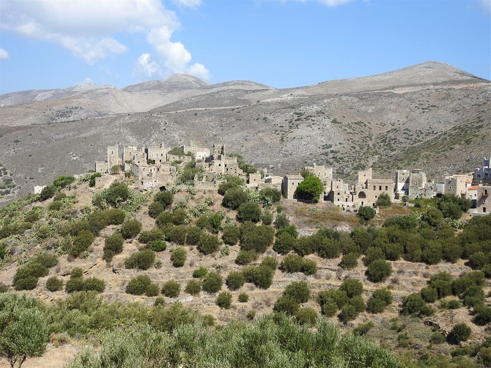
The town of Oitylo is built at an elevated plateau overlooking the Oitylo bay.
Wandering in the traditional village of Oitylo with the stone houses and paved paths, the visitor passes through the picturesque square of the village. There is a traditional café here as well as the church of the Dormition of the Virgin. Unfortunately, the town is rather neglected, and there is nothing to do around here for entertainment. All tourist activity has been long moved down to the beach. From the location called "Frygano", there is an impressive view of both the Oitylo Bay and the Myllagados gorge, which separates Oitylo from the village of Kelefas and its beautiful castle.
In Oitylo near the modern building of the primary school, and across from the west entrance of the church of Taxiarches, stands a huge building (it is ruined today) used since the days of the establishment of the Greek state, until the middle of the twentieth century for elementary school, so it is called "old school".
There is, however, another bizarre name that, until now, historians have not been concerned with the investigation, and the local tradition has greatly preserved the name "palace".

Oitylo. Typical architecture of Mani.

The "palace" of Oitylo.
The "palace" was built between 1407-1415 when Emperor Manuel II Palaiologos appointed his son Theodoros II as Despot of Mistras. Because Theodoros II was a minor, the emperor also sent Manuel Frangopoulos as his temporary guardian. In those days, Oitylo was a mighty castle and "palace" used as the residence of the Despot of Mistras and his guardian. For centuries, the palace was used as a house for princes and other noble persons.

Oitylo seen from Kelefas castle.
Kelefas castle
Even though the best views of Kelefas castle (Κελεφάς) is from Oitylo, there is no way to directly cross the gorge that stands between them and reach the castle. So, one must go down to the beach and take the main road towards Neo OItylo. On the main road, just after passing the Itilo Hotel, take the road on the left hand, and in 5 minutes (~3 km), you park your car in front of what used to be the entrance to the castle. Enter the castle with caution as the vegetation is thick, and there are rocks everywhere.
 and the walk on the castle walls (yellow dotted line).")
The road to Kelefas castle (red line) and the walk on the castle walls (yellow dotted line).

Kelefas castle seen from the road going from Neo Oitylo to Kelefas village.
It is relatively easy to climb up the battlements and walk at the top of the walls (at your own risk 🤩). You can reach as far as the northeastern corner of the walls, from where you have great views, not only of the Oitylo bay but also of the gorge and the town of Oitylo.
Me on the battlements of Kelefas castle.

The Kelefas castle was built in 1679 by the Ottomans to contain the Inner Mani region. Some years later, in 1685, the Maniots besieged the castle. They sent messengers to Venice so the Doge could send a fleet to help them capture the castle. The Venetians were currently at war with the Ottomans, so they agreed and sent a fleet under Francesco Morosini. As soon the fleets bearing the symbol of St Mark entered the bay, the Ottoman garrison surrendered. A year later, the Ottomans returned with a strong force and laid siege to the castle but were driven back. Along with the rest of the Peloponnese, the castle remained in Venetian hands for about 30 years, but in 1715 the Ottomans recaptured the Peloponnese. Around 1780 the Ottomans abandoned the castle, which became derelict.

Kelefas Kastle.
Tsigou Monastery

Kelefas Castle at its full glory.
Just six kilometers north of Oitylo stands a small monastery lost in the mountains' beautifully wild landscape. Half the road there (till a sharp fork the road forms) is well paved with asphalt (the good road continues to Kryoneri village) while the rest half is a dirt road, but not that difficult to drive on it with an ordinary car.
The Monastery of Tsigou, or Μonastery of the Petrouliani family, is dedicated to the Virgin Mary and celebrates the Birthday of the Virgin on September 8. It belongs to the Stefanopoulos family.
.")
From Oitylo to Tsigou Monastery (red line).

Tsigou Monastery.
The church is of Byzantine construction with a dome and a bell tower with two bells above the front door on the west side. The frescoes in the church's interior have been whitewashed, except for the Christ-Pantocrator at the dome and the frescoes of the iconostasis, which has only two entrances (instead of three). To the right of the beautiful Gate is the hagiography of Christ, to the left of the Virgin Mary and the left of the sanctuary's left entrance, the hagiography of the Nativity of the Virgin, and above the dodecahedron with figures of saints.

The iconostasis and its frescos of the katholikon of Tsigou Monastery.
A fortification wall protects the church and the rest of the monastery buildings. Most impressive of all the fortification structure is the half-ruined round tower (goulas or tabia) on the right as we enter the arched monastery gate, which testifies the need to control the area passages.

Tsigou Monastery. The katholikon and one building are fully restored.
The monastery complex, apart from the church, which is maintained in good condition, and one more building to the east, which has been totally restored recently, is still in ruins since the civil war when the Hites (*) (Organization X) of Itilo, most of whom were from the Stefanopoulos faction, killed the Petroulians, owners of the monastery. The massacre has been recorded by a little girl who survived it.
(*) The Organization X (Greek: Οργάνωσις Χ; commonly referred to simply as X ("Chi" in Greek), and members as Chites (Χίτες)) was a royalist, far right-wing militant resistance organization set up in 1941 during the Axis occupation of Greece. Initially, an anti-Axis resistance organisation, gradually shifted its focus towards anti-communism, collaborating with the Axis authorities against EAM (The National Liberation Front, whose main driving force was the Communist Party of Greece) affiliates. Following the end of the Axis occupation, it played an active role in persecuting communist sympathizers during the White Terror and various military operations of the Greek Civil War.
 opposite the katholikon (left) and the fresco of the dome (right).")
Tsigou Monastery. The round tower (goulas) opposite the katholikon (left) and the fresco of the dome (right).
Dekoulou Monastery
In the location Karidi, on the slope that descends from Oitylo to the sea is located the Dekoulou Monastery.
On the road from Neo Oitylo to Oitylo there is a sign to turn right. The monastery is less than one km away from the turn.
The monastery is triune monastery, dedicated to the Zodochochos Pigi, Agios Panteleimonas and Agios Nikolaos.

Follow the red line to reach the Dekoulou Monastery from Neo Oitylo and Aeropoli.

Dekoulou Monastery seen from Neo Oitylo.
The monastery was founded by the Bishop of Mani Daniil and his brother Nikiforos, who were descendants of the Dekoulos family, a branch of the Hellenized Florentine family of Medici (Giatrani).
There is no exact information about the date of the Monastery's foundation; however, from an inscription, we know that it was renovated in 1765.
The katholikon of Dekoulou Monastery.


Dekoulou Monastery courtyard.
The katholikon (church) of the Dekoulou Monastery is a one-aisled cruciform domed temple.
It is adorned with impressive frescoes by Anagnosti Dimagelea, dating back to 1765. Simultaneously, the wooden iconostasis was carved, an exquisite example of ecclesiastical wood carving, specially developed in the Messinian Mani during the late post-Byzantine period was formed under the influence of the art of Byzantium and the West.

Fresco representing the zodiac circle at the katholikon of Dekoulou Monastery.
. The dome of the katholikon (right).")
The wooden iconostasis of the katholikon of Dekoulou Monastery (left). The dome of the katholikon (right).

Frescoes in the katholikon of Dekoulou Monastery.
In 1770, in the Monastery area, the historical covenant between the Maniats and the Russian Admiral Orlof was signed to beg the Greeks' revolution against the Ottoman Empire.
The Orlov revolt
The Orlov revolt (Ορλωφικά) was a Greek uprising in the Peloponnese and later also in Crete that broke out in February 1770, following the arrival of Russian Admiral Alexey Orlov, commander of the Imperial Russian Navy during the Russo-Turkish War (1768–1774), to the Mani Peninsula. The revolt, a major precursor to the Greek War of Independence (which erupted in 1821), was part of Catherine the Great's so-called "Greek Plan" and was eventually suppressed by the Ottomans.
"The Orlov rebellion … was absurd in conception, devoid of genuine libertarian teleology and brutal and chaotic in execution." – J. C Alexander.
, by Ivan Aivazovsky (1848).")
Battle of Chios (1770), by Ivan Aivazovsky (1848).
.")
Destruction of the Turkish Fleet in the Bay of Chesma. Jacob Philipp Hackert, 1771. (The Hermitage, St. Petersburg).
After prompting the Maniots to raise their war flags, the Russian fleet left 50 Russian soldiers to help fight in the ground war while the fleet sailed on to the Aegean Sea. With the assistance of Greek islanders, the Russian fleet could score a major victory against the Turkish Navy in the Battle of Chios (Cesme), but this did not help the Greek army in Morea (Peloponnese). As the Russians failed to bring the forces they promised, the revolt was soon crushed.
The reasons for the failure of the uprising were manifold. The majority of the Greek inhabitants of Peloponnesus met the ‘freedom-fighters’ with complete indifference. As well, many powerful Greek clans refused to compromise their own privileged position by taking part. Indeed, some of the most powerful clans, such as the Zaimis family, actively opposed the uprising, not for any other reason than being led by the Benakis clan, who were their rivals. One member of the family, Andorusakis Zaimis, even wrote to Muslim notable Syleyman Penah of Gastouni, reassuring them that he had nothing “to fear from our rayas, so please be at ease. If any one of them participate in the rebellion, I will kill them myself”.
Raselianiko Monastery (Panagirsa)
There is a small church built in a cave, on a cliff above the Monastery of Dekoulou, which was a center of worship since ancient times. The church belonged to a the Raselianiko (Ραζελιάνικο) Monastery. It owes its name to the family of Razelos Medikos-Yiatrianos which, after the liberation took the Monastery from the monks, as it belonged to them by inheritance.
 from Neo OItylo or Areopoli. The red line shows the path one has to climb down to reach the little church. The stone inscription and the little church are seen in the pictures.")
How to arrive to Panagitsa (red line) from Neo OItylo or Areopoli. The red line shows the path one has to climb down to reach the little church. The stone inscription and the little church are seen in the pictures.
. The view from the chapel door (right).")
The path leading to the chapel of Raselianiko Monastery (left). The view from the chapel door (right).
Before that the Monastery was known as Gitraniko Monastery or Panagia Giatrissa (Virgin Mary the Healer).

The entrance to Panagitsa.
The church (rather a chapel) is reached by a whitewashed stone staircase, which leads to a tiny court with beautiful views over the bay.
The church itself is built in a natural cave, the opening of which is built up, leaving only 3 openings: the entrance and two small windows. The church's entrance has a niche above it, in which a fresco of the Virgin Mary survives. The two windows positioned on the right side of the entrance are used to let the daylight into the church. There is a small bell hanging by the entrance.
The church is tiny, but it has impressive frescos that cover almost all of its walls.

The interior of the Panagitsa chapel.
Today, only the monastery's katholikon (church) exists, the church of Panagitsa Spileiotissa (Virgin Mary of the Caves). To the locals, the little church is known as Panagitsa (little Virgin Mary church). According to the tradition, the church was built by the Byzantine Emperor Alexius Komninos (1081-1118), who embraced the monastic life and became a saint and patron of Oitylo (known as Voitylo those days). They say that every time a serious epidemic fell on Vojtylo, the monk Alexius appeared in the sky with a candle in his hand, and he was expelling the plague.

The stairs leading to the little church of Raselianiko Monastery.
Even though the church is well hidden and cannot be seen from anywhere, it is not difficult to reach. On the side of the road leading to Oitylo, they have recently erected a stone inscription (resembling a menhir), which cannot be missed. By this “monument,” there is a path going down. Follow this path for about 100m, and at some point, you will see the church's whitewashed stairs. The time I visited, the church's door was unlocked, so I managed to admire the interior.

Panagitsa chapel frescos.
Limeni
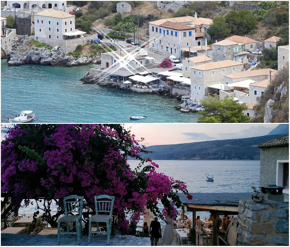
The most beautiful village in the whole Mani, is located here and is called Limeni (Λιμένι). Limeni has served as the Areopolis haven. Limeni with its stone houses, its crystal-clear waters and beautiful sunsets stole my heart. The village is just a strip of land restricted by the sea and the mountains behind it. Strolling at the only road of the village you see imposing stone houses and among them glimpses of the sea. The taverns and the guest houses almost touch the sea, savoring its saltines.

Limeni.
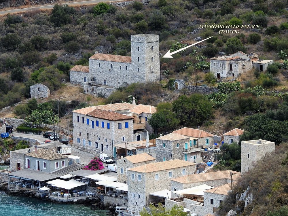
Among the houses of Limeni, there are two of historical importance. The “Mavromichali Tower” (“Mavromichalai Palace”) has been built during the middle of the 18th century (1762) by Pieros Mavromichalis (father of Petrobey) and was officially the first residence of Petrobey Mavromichalis, warlord of Mani and leader of the Hellenic war of independence against the Ottoman Turks. The palace complex consists of a large oblong house and a four-story tower on its southern side.
The stone residence, just opposite the “Mavromichalai Palace”, constructed not much longer after the palace did, is also referred to as “Sissition” (mess hall), since it was provided from Petrobey to his arm-chiefs as a place of resting and messing. Inside the residence, Petrobey ancestors lived until the middle of the 20th century, when it was abandoned, which resulted in its isolation and eventual collapse. The Hellenic Ministry of Culture, by law, has proclaimed the palace as a unique historic preserved building and restored it to become a museum. The "Sissitio", which is located on the rocky shore, has also been fully restored to its original glory and today operates as a luxurious guest house.

Limeni in the dusk. "Mavromichalai" Tower seen on the right.
Limeni is built around a narrow strip of land along the rocky coast, confined by the steep hills. It is actually built around the main (coastal) road. Follow this road to its west end and enjoy a couple of restaurants/cafés and small rocky beaches. The road continues as a dirt path to a small graveyard (with its small chapel) and finishes at a lighthouse. From the graveyard, there is another path going up to Hotel “Limeni village”. At this small graveyard stands the monument-tomb of Petrobay Mavromichalis. The area offers tranquility and wonderful vistas of the Oitylo Bay.
. At the village graveyard stands the tomb and bust of Petrobay Mavromichalis (right).")
The rocky coast that leads to the Limeni graveyard has little rocky beaches (left). At the village graveyard stands the tomb and bust of Petrobay Mavromichalis (right).
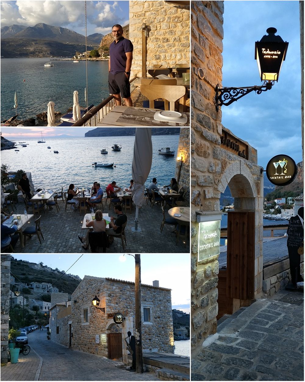
"Teloneio" bar-restaurant.
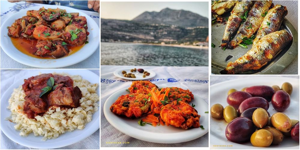
The best option is to choose from the appetizers list: plates here are of good value. From the appetizers, I tasted the grilled vegetables mille-feuille (with talagani cheese, capers & extra virgin olive oil) and from the salads, the yummy Sea salad (with broccoli, cauliflower, carrot slices, shrimps marinated with ouzo, grilled squid & extra virgin olive oil dressing). I tasted the most crunch and tasty fried filleted anchovies I ever had and homemade ravioli with fresh shrimps from the main dishes. It seems that the menu changes from season to season, but I am sure you will always find something to surprise you.
The restaurant I recommend in Limeni is “Teloneio” restaurant and cocktail bar. During my first holidays in the area (back in 2018), I fell in love with the place. During my October 2020 stay, though, I was not very enthusiastic about it. It seemed to me unreasonably overpriced and the food a bit pretentious. Maybe the place has not changed over these two years, but certainly, I did change. After discovering in Neo Oitylo, "Karavopetra tavern", I do not see why to pay double the price for fusion cuisine in the first, instead of eating delicious traditional food in the second.
Housed in two-story old buildings, Teloneio consists of two terraces separated by the main building. On the first terrace, the big one extended on two levels is the restaurant; and on the other terrace is located the cocktail-bar, the lounge.
The lounge has white leather sofas where you can enjoy a light meal (pizza, club sandwich, etc.) or ice-cream, drinks, refreshments and desserts.

Dinner at "Teloneio" restaurant.

More goodies at "Teloneio" restaurant.

Mille-feuille and Crème brûlée with pistachios.
And yes, there is a dessert menu, too. My best? Crème brûlée with pistachios (not available anymore....😥).
Both terraces have unrivaled views of the bay. Nothing better than having a romantic dinner here.
Most of the sites about eating in Limeni recommend the “Takis” fish tavern ("Ο Τάκης"). It is recommended especially for its fresh fish and other seafood bites. The tavern is located on the rocky shore and really looks very beautiful, but unfortunately, I did not visit it.
"Takis" fish tavern. Most of the sites about eating in Limeni recommend the “Takis” fish tavern ("Ο Τάκης"). It is recommended especially for its fresh fish and other seafood bites. The tavern is located on the rocky shore and really looks very beautiful, but unfortunatelly I did not visit it.

Sunset at Limeni.
Areopoli
Areopoli (Αρεόπολη), known before 1912 as Tsimova (Τσίμοβα - a Slavic word that means “city of the devil” or “small plain”), is the capital town of Mani. The word Areopoli means "city of Ares", the ancient Greek god of war. The Greek War of Independence was started at Areopoli on March 17, 1821. Today Areopoli has grown into a flourishing town with lots of hotels and restaurants. Tourists stroll in the narrow streets of the old town admiring the stone tower-houses and churches.

Kapetan Matapa street in Areopoli.

Areopoli.
, Kapetan Matapa Square (middle) and 17th of March 1821 Square (bottom).")
The three squares of central Areopoli. Athanaton Square (top), Kapetan Matapa Square (middle) and 17th of March 1821 Square (bottom).
The main street of the town, Kapetan Matapa Street, runs through the town and connects three squares: 'Athanaton Square', 'Kapetan Matapa Square' and '17th of March 1821 Square'. The churches of 'Agios Athanasios', 'Virgin Mary (& Agios Charalambos)' and Agioi Taxiarches stand on each of the three squares respectively. Vehicle traffic is prohibited on Kapetan Matapa Street, full of nice cafés, bars, and restaurants.
Agioi Taxiarches or Taxiarchis, the metropolis of Areopolis, has an important sculptured iconostasis and an exceptional stone-carved decoration. The impressive multilevel bell tower of 1836 can see from everywhere in the city. Its 18th-century dome externally is decorated with reliefs of the zodiac. Of particular interest are stone lintels of the gate sculpted in 1798. The lintel reliefs above churches’ entrance date back to 1798 and depict the archangel (Taxiarches), Gabriel and Michael. The frescos of the church have no much interest as they are relatively new. Here in this church, on March 17, 1821, the Maniats, headed by Petrombei Mavromichalis, the last bey of Mani, gathered for the mass, and after that, in front of the Church, they raised the banner of the revolution, known as the “Flag of Mani”. The flag was white, with a blue cross in the middle. Above the cross, the words «Νίκη ή Θάνατος» (Victory or Death) is written, and bellow it the words “Ταν ή επί τας".

The metropolis of Areopolis: Agioi Taxiarches.

The bell tower of Agioi Taxiarches and a sample of the frescoes.

The “Flag of Mani”.
Not far away from the main street (next to the church of Agios Ioannis) stands the Byzantine Museum of Mani, housed in Pikoulakis Tower. The complex is a fortified mansion with a tower and a tower house, built in the pre-revolutionary years, donated by Ioannis Pikoulakis to the State.
The museum’s permanent exhibition deals with the "Stories of religious faith in Mani." Not far from the Pikoulakis Tower stands the towerhouse of Stylianos Mavromichalis, a great example of a fortified tower.

The Byzantine Museum of Mani is housed in Pikoulakis Tower.

The towerhouse of Stylianos Mavromichalis.
Continue the road passing by the tower, and at the small square, some meters to the north, you will see a small chapel. The frescos (what has been left of them) inside the chapel are beautiful.

The little chapel close to the towerhouse of Stylianos Mavromichalis.
“Mrs Milia Bakery”
There is no site or book about Areopoli which does not prompt you to visit the bakery “Mrs. Milia Bakery” (Φούρνος «Της κυρά Μηλιάς»). It is supposed to be one of the oldest or maybe the oldest bakery in Greece. At one side of the historical square of “17th March” there is a stone well and just behind it is located this traditional oven. Milia Tsatsoulis married a Maniot who died at the age of 29 and had 6 children. Since then, she has dedicated herself to the wood-burning oven of her mother-in-law and her children. In 2012, its multigrain bread was awarded as the best bread of Greece. Every morning from the oven comes out freshly baked bread, cookies, pies, and “travichtes” (τραβιχτές). Travichtes are made of salted dough, shaped like flat gondolas, and fried into olive oil. This traditional Maniot bread is served with cheese or ham or eaten alone as a street snack.

The traditional Bakery of Areopolis “The oven of Mrs. Milia”, and its traditional "travichtes".

Me eating a delicious travychti from Milia's bakery.

More of Areopoli.